 |
| Rugged
- first impressions of Montana |
|

View from road coming into East Glacier National
Park from Browning
|
| July 2003
Finally, I have seen Montana. I have always liked mountains.
Watching movies like Legends of the Fall, A River
Runs through it, and Of Mice and Men, I've always
wanted to visit Montana. Also, my excitement was built by
the description told by my friends (CP and KM), who have lived
in Montana for a year. Having seen the Rocky Mountains in
Colorado and Utah, I thought the Rockies of Montana should
be even more extreme and beautiful.
|
|
| |
|
|
West side of Glacier NP
Good sunsets and cities nearby. |
|
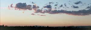
Near Kalispell - unlike the Rockies in Colorado, the high mountains are
to the east and not blocking the sunset.
|
|
| For the mountains,
they are more desolate than Colorado's green mountains
(like the type near Colorado springs). The flight into
Kalispell was beautiful. Because we flew into a place
that was west of Glacier National Park, I got to see
the tremendous glacier-carved mountains from the sky.
Unfortunately, the airplane window was dirty so a good
photo wasn't possible. When I saw the mountains of West
Glacier National Park, I was disappointed. The last
one third of the mountain tops are bald and sparsely
covered with bleached white trunks of dead, weather
beaten trees. Everything is rugged and I was looking
for the softer side of Montana. This would not be found
from the threatening scenery of West Glacier National
Park. |
| |
|
|
|
|
| |
|
| East
side - better lakes, more dramatic terrain |
|
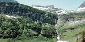
East side of Logan's Pass
|
|
| East Glacier
National Park was beautiful. On the drive to St. Mary's
campground, there are many wildflowers along the sides
of the road. A couple vistas of the jagged mountains
with snow patches are available to the alert eyes. In
the park, there are enough trees of all varieties, not
many dead, scruffy pines. This, along with the flowers,
gives the east side of Glacier National Park a welcoming
ambiance. |
| |
|
|
|
|
| |
|
| Geology
- sculpted by glaciers |
|

Road to Many Glacier Lodge - Glaciers carve long
narrow 'U' shaped valleys, providing sweeping views
of the mountain. In contrast, most valleys
are twisty, 'V' shaped and one mountain range
are hides the other. |
|
East
Glacier National Park - St. Mary Lake
Lakes and the bowled out mountains that hold are clues
to the existence of huge glaciers that carved out the
area. First the Lewis Thrust Fault collided with another
plate and upheaval layers of rock. Then a glacier slowly
pulled softer rock away from the rock face. This Lewis
Thrust Fault ends here, at the Red Eagle Mountain. At
the east entrance of Glacier National Park (Glacier
NP), go to the visitor center near the St. Mary's campground.
Browse through the books on hiking and look at the 3D
relief map of the park. It has the names of many of
the mountains and shows how the campgrounds, roads and
hiking trails are positioned between the terrain. For
photographers or the adventurer, the 3D map is useful
for finding good trails with scenic views.
East Glacier National Park - Red
Eagle Mountain
On Red Eagle Mountain, scaring can be seen. They look
like deep gouges made from an ice pick being scraped
diagonally across the rock face of Red Eagle Mountain.
A crisscross pattern with the rock layers that are also
diagonal, but in the opposite direction. The deep gouges
can't be made from erosion because gravity would loosen
rock in a straight down manner, making an up-down gouge,
not across. However, erosion has taken place. Melting
snow and gravity are what made wide ravines from the
top that funnel down one third of the mountain. For
the gouges and lake, they were formed from the St. Mary
glacier as it slid east. Another reason for the gouges
is the rock crystalline structure. Parallel occur on
the weak cleave lines inherit in the rock. If this interests
you, there are geology books at the visitor center near
the St. Mary campground that have more information specific
to Montana and Glacier NP. The scarring gouges made
from the glaciers can be seen on the photo.

Scarring on Red Eagle Mountain. See from
Rising Sun Campgrounds (Click for larger photo).
Books - Road Guide by Thomas Schmidt
Available at the Visitor Center, the book Road Guide
to Glacier and Waterton Lakes National Parks is a steal
at $6. The author Thomas Schmidt has been a great source
of scientific information about the geology, and animals
of Glacier NP. Also, it has photos of the scenic roadside
stops with the names of the peaks. Besides geology and
animals, many paragraphs tell local Indian tales associated
with the land or history.
|
|
|
|
|
|
| |
|
| Lakes
of changing color |
|
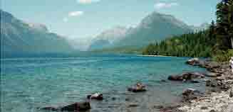
Lake McDonald |
|
|
Dark greens,
and deep blues are often the colors of the beautiful
lakes formed by glaciers. Because of the amazing color,
you might wonder if the water is different from other
lakes. What could make such a dramatic change? What's
different from other lakes is the Mie effect, but I
have to check on that name. Tiny particles called rock
flour or glacier flour is
created from glacier movement. As the glacier slides,
it pulverizes the rocks and the rock face on the surface.
These particles are suspended in the water whereas larger
particles sink. Because of the small size of the rock
flour particles, blue and green light is reflected.
Hence the magnificent color of the lakes. Meltwater,
water coming from the glaciers carry the rock flour
to the lakes.
Actually, the lakes take on most of
their color from what is reflected. Usually the pine
trees or the sky. Test it out. If the land on the other
side is flat, then the lake will most likely be a dark
blue (unless it is cloudy, then it will be gray or white).
However, if the other side has mountains with trees,
then the lake will have an emerald green (I like this
color better for photos). So if you don't like the color
of the lake, get another angle. Hike or drive to another
point. Climb higher and look for a meadow or cliff.
For some great photos of a very green St. Mary Lake,
I hiked three miles on the Siyeh Pass trail to a cliff.
Photo tip - the color is better from
a higher viewpoint so go on some uphill hikes.
|
| |
|
|
|
|
|
| |
|
Hikes
- bring plenty of water, the air dries you out
Wish my sister were there. The hikes at Glacier NP
remind me of the hikes at Zion
NP. |
|
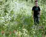
My nephew Noah hiking |
|
Maps

Hidden Lake (3 mi round trip, elevation
change 460 ft) - Trailhead is at Logan's Pass. Look
on the hills for big horn sheep or mountain goats. Best
short hike; everyone can do it. But it is hard to find
parking so go in the early morning or late afternoon.
Siyeh Pass (11 mi to the pass, elevation
change 2,230 ft; 5 mi to a good photo spot, round trip)
- Park at the Sunrift Gorge roadside stop. Start the
hike by looking at the rapids under the bridge and end
there by splashing your face with the icy water.
Otokomi Lake (10.5 mi round trip,
elevation change 1,900 ft) - Camp at the Rising Sun
campground for a convenient start because the trailhead
is 2 minutes away beside the general store. Hike along
a river that provides glimpses of waterfalls.
|
|
|
| |
|
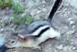
| Wildlife
photos and flowers - Unfortunately, I never saw a grizzly |
 |
|
| Best spots
for wildlife are on the roadsides. This is convenient
and you have the protection of your car. Never saw a
grizzly, but if I did, I would taken many photos (from
a distance).
To get a close up photo, use a telephoto lens or just
settle for a postcard. Even though the animals in the
park have been around people for a long time, remember
these animals are unpredictable. Do not approach them
or pursue the animal into the woods or up a hill. While
hitching a ride with a park ranger (specializing in
wildlife), I was told approaching the animals is not
allowed in the parks and he always enforces this rule. |
|
|
|
|
| |
|
|
| |
|
 |
 |
|
|
|
|
|
|
|
|
|
|
|
|


